“The Cut” is not a natural ravine. Fun Fact #81

Image of a 100' tall 80' ditch being created by two high pressure water blasts in operation. People look like ants in this image.

Why was Portland’s Mayor against the construction of “The Cut”?

Image of a 100' tall 80' ditch being created by two high pressure water blasts in operation. People look like ants in this image.
St Johns Sluicing to Creat Cut c. 1907. Courtesy Norman Gholston.

Portland’s mayor Henry Lane’s strongly opposed giving SP&R a franchise in 1906. SP&R had opted to create a trench rather than a tunnel. Lane declared this proposal “a defacement of property and a visual blight [an] out-and-out give-away…destroy the unity of the neighborhood.” Portland City Council members overrode the Mayor’s veto. Leading to “the Empire Maker”, James J. Hill receiving the lucrative franchise. Ultimately, Hill’s considerable influence and financial resources ultimately prevailed and the Spokane, Portland & Seattle Railway (SP&S) received the franchise.

A Deep Divide, A Looming Threat: How Railroad Greed Left St. Johns Vulnerable

Trench with trains
Trench dug by Spokane Portland & Seattle Railway through North Portland. c. 1907 Courtesy OHS Oregon Journal 371n5131

Residents of St. Johns consider “The Cut” to be the neighborhood boundary; it is close to the historic boundary between the historic cities of St. Johns and Portland. The construction phase pre-dated the St. Johns Bridge (19310. Unsurprisingly, all of the four original 1909 steel deck truss bridges over “The Cut” were designed by Ralph Modjeski. The bridges over Fessenden, Lombard and Willamette today are owned by Burlington Northern Railroad and replaced over a dozen surface streets that once flowed out of  St. Johns. According to, Egon Terplan, Regional Planning Director SPUR states in a documentary about Modjeski: “Our failure to maintain these bridges threatens our future.”  Medjeski also designed the railway bridges on either end of the cut that cross the sloughs and the Columbia and Willamette Rivers.

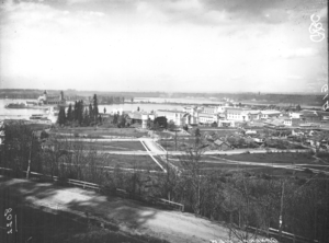
Local lore in North Portland speaks of a deliberate divide, a chasm carved to isolate the then-independent City of St. Johns from the burgeoning city of Portland. However, the enduring geographic scars are the responsibility of the railroads, an industry whose relentless pursuit of progress historically overshadowed community well-being. The construction of “The Cut” an eighty foot deep ravine disrupted the evolving streetcar system, and funneled access on the peninsula onto four bridges spanning The Cut. The construction cost was  a three-million-dollar project (equivalent to $74.46 million in 2025).
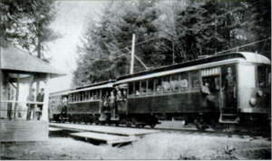
Image of Scottish atried man posing in the back seat of a 1900s car. in a winter coat with round traditional hat.
Hill, James Jerome (1838-1916) Courtesy HistoryLink.org

James J. Hill

This physical manifestation of ambition was largely the brainchild of railroad magnate James J. Hill, the driving force behind the Spokane, Portland & Seattle Railway (SP&S). Known as “the Empire Builder” by admirers – a man who famously opposed labor unions, stating they would cause “grave financial reverse”. The Cut offers a direct, level route to a vital railroad bridge, ensuring trains maintained speed, unhindered by natural topography or existing neighborhoods. The earth excavated filled critical riparian marshlands, reshaping the natural environment to serve the burgeoning rail infrastructure.

The first train navigated “The Cut” on November 17, 1908. SP&S’s competition, the Oregon and Washington Railroad and Navigation Company, started operating on the one-mile long Peninsula Railroad Tunnel parallel to the cut in 1911. The City of Portland ordinance granting both companies franchises. “The Cut” with its massive excavation was notably unfavorable, lacking a construction time limit or a recall provision, potentially violating the City Charter’s common user requirement, and stipulating that the railroad would bear no costs beyond their own land investment and the replacement of existing streets with a mere four steel traffic bridges: N Willamette, N Lombard, N Fessenden (BNSF owned), and N Columbia (PBOT owned).

History’s Long Shadow 

North Willamette Boulevard overcrossing in Portland. Built in 1909 by the Spokane, Portland and Seattle Railroad, it is distinctive as one of only four hanging deck trusses in the state; it also sports attractive vintage lattice steel railing. This bridge was strengthened in 2011 so that it could continue to be a useful part of the transportation system.
North Willamette Boulevard Over crossing image c 1989 bridge strengthened in 2011. Built in 1909 by the Spokane, Portland and Seattle Railroad, it is distinctive as one of only four hanging deck trusses in the state; it also sports attractive vintage lattice steel railing. Image Courtesy ODOT

Today, this historical decision casts a long shadow. Where sixteen streets once seamlessly connected the St. Johns Peninsula, only four now remain, reliant on bridges to traverse the artificial ravine. The consequence of prioritizing railroad efficiency over community well-being is a looming crisis. Experts have determined that the four bridges spanning “The Cut” are highly vulnerable to collapse in a significant seismic event. This leaves the approximately 15,291 residents of the St. Johns Peninsula facing the terrifying prospect of being physically cut off.

Fessenden Bridge Courtesy ODOT

Today’s Crisis

The current crisis reflects a century of perceived neglect. The community seeks a seismic upgrade of the Columbia Blvd bridge, managed by PBOT. Without it, the fate of North Portland Peninsula residents in even a mild quake is a gamble. Without a functioning bridge, families will be separated, and emergency access will be severed. An emergency route on Columbia Boulevard is imperative.

Architectural Detail of the lace like railing
Courtesy ODOT


Fun Fact #74 Part Two of Recycle, Reuse Repurpose, Ravage

Fun Fact #74 Part Two of Recycle, Reuse Repurpose, Ravage

“Fun Fact” Urban Legend #74 

North Portland community members distraught over pool closures rehash a mysterious source of parts repurposed to facilitate original construction of Pier Park Pool. What was the source of those now failed parts?

According to Urban Legend a liberty ship – if that’s true maybe original parts were replace because the timeline for use of parts produced in 1941 in a 1940s structures seems suspect.

   After losing the MLC Pool to budget cuts I prioritized moving my family to a community with a small neighborhood pool.  Images of the pool my children first swimed in were included in Fun Fact #15 in 2015.  Pier Park is a 62-acer park dedicated on March 12, 1922. The park itself grew by absorbing land in 1960 that had once served as WWII Parkside Homes defense housing.  Once again this year my family has experienced a summer without a neighborhood pool. The 84-year old swimming facility (pool) was shut down this summer because of a significant failure in a water line.  Where did the parts come from that  the original designers of the pool repurposed for the  inner mechanical workings? 

Blue Print Above Courtesy City of Portland Archives

    Pier Pool’s water pump is attributed to being a part repurposed from a World War II Victory Ship. The online Bath House & Swimming Pool blueprints drafted on March 7, 1940 by Knighton & Howell lack detailed mechanical details. The Pier Park Pool opened prior to as liberty ships were being produced. Toy industrial factories and other factories stopped producing consumer goods and started producing items for military use. It is potentially that a part pulled off “new” from Portland’s liberty ship production line but the timing seems off. The other guess would be that a pump failed a decade in and parts were pulled off a deconstructed liberty ship post war. As a child I created fictional uses for the Suisun Bay Reserve Fleet colloquially known as the mothball fleet – perhaps a fellow daydreamer was also pondering ways to make use of the US mothball fleets.

Al Monner image courtesy OHS collection swim lessons YMCA – Our city’s future lessons without water?

Fun Fact #73 Part One of Recycle, Reuse Repurpose, Ravage

Fun Fact #73 Part One of Recycle, Reuse Repurpose, Ravage

Fun Fact #73

Question: To what city did the 1905 Lewis & Clark Exhibition water tower relocate? 

Answer: St. Johns


Part One Of Reuse Repurpose, Ravage

My fascination with water towers was kindled during my Place Matter employment. One of the nominated locations was a PWA era public pool, in Harlem NYC. The local narrative iterated by elders was prior to the construction of the PWA pool was learning to swim in rooftop water towers prior to attempting river swims. I have since pestered friends of friends who habited in water towers converted into dwellings and hotels, as well as being drawn to fictional horror stories and researching water tower tragedies like the collapse of the West Bluff Water Tower in Peoria, Illinois. The 1905 Lewis & Clark Exhibition Water Tower was highlighted in Fun Fact #50 in 2019. It was years later that I encountered information that the water towers were relocated.

A Gallery Of Water Tower Images 

The first five are of the towers when they were next to the Forestry Building.  The green space alien tower is the most recent replacement in St. Johns.

In the early 1900s city residents clamored for additional water towers to be built in downtowns as a tool for firefighters. Portland’s Fire Chief Campbell articulated to the press that many costly NW fires could have been avoided if there were more water towers. “Every large city has a water tower as part of the equipment of its fire department.” (9-14-1907 Oregonian p 10). Campbell died in the collapse of the Union Oil Plant building as a result of a fire in 1911. Chief David Campbell is honored along with 76 other Portland Firefighters at Fireman’s Park on SW 18th & Burnside.

The original St Johns Water Tower in 1903 Courtesy St. Johns Review

The City of St. Johns like their neighbor Portland saw the need for additional water towers. Sy. Johns acquired the Lewis & Clark Fair Water Towers that were no longer required after the 400-acre fairgrounds closed on October 15. 1905. This post includes an image of the original towers in 1905 as well as an image of a greatly altered when the round towers were reassembled and added on to an existing rectangular tower. Cassandra Bird published an article for the St. Johns Review as well as the letter to the editor below advocating for preservation:

Although Portland prides itself on oddities, few things are keeping us weird these days. In St. Johns, a green water tower represents pride of place, and the city is trying to sell it. The city says the tank at North Willamette Boulevard and Oswego Street is on track to be “disposed of” because it is no longer “of use.” But it is used as a location marker, it shows our history, it is replicated on postcards, and it defines our skyline.

Oregonian Letter to the Editor 3-24-2021 by Cassondra Bird, Portland

The modern green water tower and the land under it sold in June 1922 for $450,000 according to an  April 22, 2023 Willamette Week article “Why Is Portland Selling Off Its Water Tanks?”. Cities rise and fall based on access to water. St. Johns is no different reemerged with Portland in 1915 of independence mostly for access to drinking water after a decade of population growth. Fun Fact #68 touched on why St. Johns seceded from Portland in 1898.

We offer tours of Portland’s St. Johns Neighborhood on the Third Saturday of each month.


Fun Fact #68 Why did St. Johns Secede from Portland in 1893?

Fun Fact #68 Why did St. Johns Secede from Portland in 1893?

Fun Fact #68 Why did St. Johns Seceded from Portland in 1893?

Above image c. 1908 A panorama view from a scrapbook of Chief B.F. Dowell’s Scrapbook 4 held by the City of Portland Archives and records center shows the waterfront at St. Johns. Among the businesses pointed out in the picture are: Woolen Mills, Flour Mill, George W. Cone Lumber Company, ST Johns Lumber Company, Shipbuilding Plant, Veneer and Basket Factory, Excelsior Mill and the Dry dock.

St. Johns seceded from Portland in 1893 because of a combination of higher taxes and unsatisfactory municipal services. The St. Johns-Portland love-hate relationship ramped up in 1891. In February of that year, the unincorporated area of St Johns was annexed by the City of Albina. (The City of Albina had been incorporated in 1887.) In a matter of months, on July 6, 1891, Portland, East Portland, and Albina were consolidated into one city. The relationship “failed” and St. Johns seceded from the City of Portland in 1898 with permission of the Oregon Legislature. And then, on February 19, 1903. St. Johns was incorporated as a city. St. Johns did not have tax base an access to clean drinking water to operate as an independent city. A majority of residents voted for the merger; St. Johns rejoined Portland in 1915. The St. Johns affirmative vote to remerge with occurred in unison with its neighbor across the river, Linnton. The voters approved annexations to Portland, increased the land area Portland’s by twenty-five percent.  Once again St Johns expected to benefit from improvements in municipal services by joining Portland proved to be a disappointment. Portland’s increase tax receipts St. Johns businesses residents did not initially enhance the quality of life in St. Johns.

Merger Ballot (There were two layers of the vote- St. Johns residents voted first. This is merger ballot is phase two for Portlanders to vote to expand the city note that the vote tally is in pencil YES 29,957 NO 5160)

During the first year after incorporation, St. Johns residents continued to pay high prices for well water when they had been enticed to merge with the promised use of the Bull Run watershed.  These requirements over inequitable access to the services within the City of Portland continue to be a source for discontent for some St Johns community members.

Learn about St. Johns on the third Saturday of the month at 3pm.


New Paper Article
For Portland according to The Oregon Daily Journal., April 07, 1915, Page 6, Image 6 the relationship with St. Johns was destiny.


Fun Fact #51 What is the name of the first park in St. Johns?

Image of lots of trees there are people on large swing, sitting down and at least one person leaning against a tree. The image was very small from within a book. Even with the best scan hard to make anything out. Text "Picnic Grounds, Cedar Grove, St. Johns Line

c.1899 View of the picnic grounds in Cedar Grove along the St Johns railroad line. City Archives A2004-002.6027 Note that the females on the far left appear to be on a swing.

Clip of 1905 Sanborn Map of St. Johns showing Cedar Park

Answer the first park in St. Johns was Cedar Park.  You still will get full points if you answered Pier Park which is the oldest remaining park in St. Johns and the first public park in St. Johns. After the timeline there is additional information on Cedar Park.

St. Johns Parks Timeline 

c.1899 Cedar Park 3 acres – 10 acres Location: North Fessenden Pier. Named for the plentiful cedar trees in the park offered for sale $10,000 in 1907 trees cleared in 1909.

1920 Pier Park 87 acres 10325 N. Lombard Street. Named for Stanhope S. Pier in 1921, who served as a Portland city commissioner in the late 1920s and as acting mayor in 1931.

1932 Chimney Park 16.76 acres Location: 9360 N Columbia Blvd. Named the city incinerator chimney that was once at the site.

1941 St. Johns Par 5.77 acres Location: 8427 N. Central St. Named for pioneer James John who settled in the area in 1846.

1968 Cathedral Park dedicated opening in 1980 23.31 acres Location: N Edison Street and Pittsburg Ave. Named for the gothic arches under the St. Johns bridge.

1971 George Park 2.03 acres Location: N. Burr Ave. & Fessenden St. Named for US Congressman Melvin Clark George.

2015 “White Oaks” Location: N. Crawford St. & N. Polk 2.92 acres Former property of Simon Benson’s child, unnamed parked but there are two heritage white oak trees on the property.

More History of Cedar Park

The first park in St. Johns was Cedar Park; a private park owned by City and Suburban Railway Co. Lines Steam streetcars operated by City and Suburban Railway Co. Lines reached St. Johns in 1889. By 1900 the company’s trains arrived at St. Johns every 20 minutes.  Cedar Park was owned by City and Suburban Railway Co. and leased out to various managers over a few years.  There was a station a Cedar Park/Cedar Grove servicing the popular picnic amusement park with 500 electrified lights, a merry-go-round, little miniature railway (moved to Mt. Tabor).  The first electrified trains reached the park in 1903.